
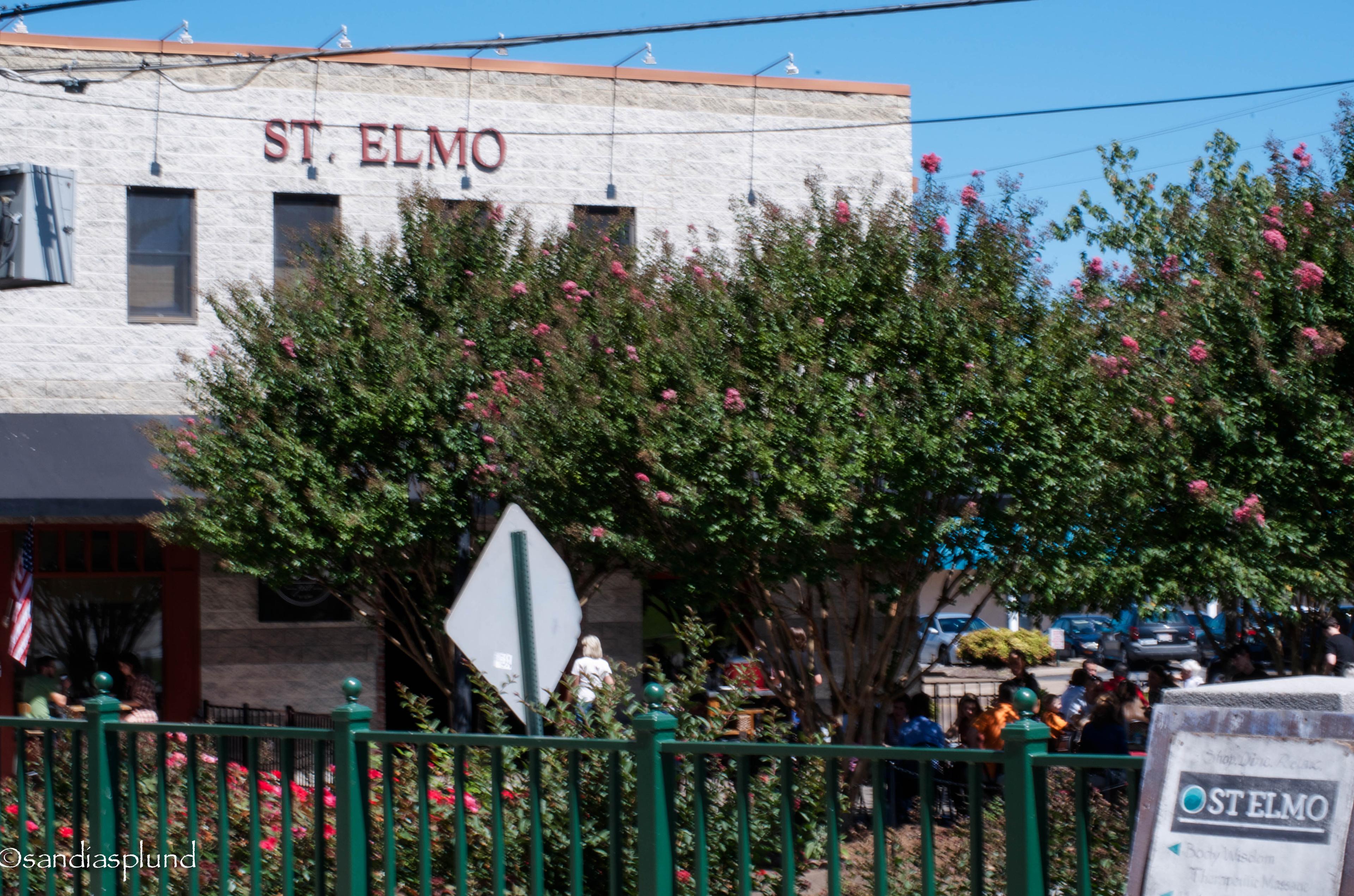
St. Elmo Homes for Sale
A historic district at the foot of Lookout Mountain
St. Elmo is a residential neighborhood in southern Chattanooga, Hamilton County, in the valley at the foot of Lookout Mountain. The National Register nomination for the St. Elmo Historic District, reference 82003976, describes an elongated area of roughly 15 to 20 blocks north to south and three to four blocks east to west, inside the city and next to the Georgia line. It places the old town limits at what it calls census tract or ward 18: Broad Street and Cummings Highway on the north, the slopes of Lookout Mountain on the west, the state line on the south, and a hill dividing the neighborhood from Alton Park on the east, with Forest Hills Cemetery north of that hill. The nomination says those western slopes are now part of Chickamauga and Chattanooga National Military Park, and it locates the listed district on Alabama, St. Elmo, and Tennessee Avenues. The listed district was drawn inside the old town limits. A house in the neighborhood is not automatically a contributing building. MLS listings use the city of Chattanooga. Addresses reviewed in 2026 on Saint Elmo Avenue and Alabama Avenue use ZIP 37409, the same ZIP the Incline Railway prints for its lower station at 3917 St. Elmo Avenue.
The neighborhood was its own town before it was a Chattanooga section. The Chattanooga Public Library's finding aid for the town records says St. Elmo was incorporated in 1905 and annexed into the city in September 1929. Plan Chattanooga's Area 4 history, still marked draft, says Colonel Abraham Malone Johnson divided his farm into residential and commercial lots in 1885, that the 1879 St. Elmo Turnpike was later paved and renamed Ochs Highway, and that the Incline Railway opened in 1895. The same history says the first direct road between St. Elmo and the rest of Chattanooga was built in 1926, three years before annexation. The city's St. Elmo design guidelines trace the name to Augusta Evans Wilson's novel, set at the base of Lookout Mountain, and say Johnson began platting in 1885. Houses here are inside the Chattanooga city limits. They are not in the town of Lookout Mountain, Tennessee, ZIP 37350, on the brow, and they are not in Lookout Mountain, Georgia, which has its own page.
Two kinds of review get confused with a homeowners association. The National Register nomination describes more than 700 buildings, 620 of them contributing, and says most of the houses were built for a middle-income working class: predominantly frame, one or two stories, in Gothic Revival, Tudor, Bungalow, Shingle, Queen Anne, Classical Revival, and shotgun forms. That is the nomination's account of the historic building stock, not a description of who lives on the street now. Plan Chattanooga's Area 4 history says the neighborhood was recognized as a local historic district in 1992. The city's design guidelines, in the section on what work needs approval, say the City Council designated the district in 1989. Those two city documents do not use the same year. They describe the same practical rule. Exterior construction, alteration, and demolition in the district go to the Chattanooga Historic Zoning Commission for a Certificate of Appropriateness, on top of an ordinary building permit. That review is not an association fee. Listing sheets reviewed in 2026 for 5405 Saint Elmo Avenue and 5505 Alabama Avenue, both in Chattanooga ZIP 37409, print no homeowners association. A 2026 listing on Alabama Avenue described the house as historic St. Elmo and not St. Elmo South. Read the name on the deed.
This page does not print asking prices. A number from one listing day goes stale, and a 1930 bungalow on Saint Elmo Avenue is not a 2021 house on Alabama Avenue. Those two 2026 sheets are the mix in miniature: an older single-family house and a newer one, both in ZIP 37409, both without an association fee printed on the sheet. Plan Chattanooga's Area 4 draft says the Urban Residential place type, which it applies to most of St. Elmo, is meant to keep the existing residential pattern and to allow infill on vacant lots in that pattern. The same draft says commercial and mixed-use infill belongs in the St. Elmo village center, while the historic district keeps its character. The nomination places the main commercial cluster, including the Incline, to the north, outside the district boundary. The village is the landmark. It is not the lot.
The railway's own site, reviewed in November 2026, lists the lower station at 3917 St. Elmo Avenue, Chattanooga, TN 37409, and the upper station at 827 East Brow Road, Lookout Mountain, TN 37350. It says the grade reaches 72.7 percent and calls the line one of the steepest passenger railways in the world. Plan Chattanooga's Area 4 history calls the 1895 railway the world's steepest and uses the marketing name America's Most Amazing Mile. Use the operator's page for the grade. West of the houses, the nomination says the old town limit meets the slopes that are now the national military park. Ruby Falls, Rock City, and the town on the brow are up the mountain. Rock City is associated with Lookout Mountain, Georgia, on its own page. A cave or a trailhead is not an amenity of a St. Elmo lot.
Public schools are Hamilton County Schools. The Lookout Valley Middle/High School site says the area it serves includes Lookout Valley, Tiftonia, and parts of St. Elmo. Parts is the school's word. It is not the whole neighborhood. The 2026 listing sheets for 5405 Saint Elmo Avenue and 5505 Alabama Avenue name Calvin Donaldson Elementary and Lookout Valley for middle and high school. The Alabama Avenue sheet prints Lookout Valley Middle and Lookout Valley High separately; the Saint Elmo Avenue sheet prints Lookout Valley Middle/High for both. That is the listing sheet, not a boundary. Assignment follows the house address, and the district can redraw it. Use the Hamilton County Schools zone finder before you trust those fields. The search below uses the city of Chattanooga, so it also returns listings outside St. Elmo. Filter for the neighborhood and ZIP 37409 when you want this area.
Old town limits, the block counts, the 700-building and 620-contributing figures, the architectural description, the military-park boundary, and the note that the Incline commercial cluster lies outside the district are from the National Register nomination for the St. Elmo Historic District, reference 82003976, at npgallery.nps.gov. Incorporation in 1905, the September 1929 annexation, and the novel as the source of the name are from the Chattanooga Public Library finding aid for St. Elmo (Tenn.) records, 1911–1922. The 1885 platting, the 1879 turnpike and Ochs Highway, the 1895 Incline opening, the 1926 road, the 1992 local-district year, and the Urban Residential and village-center wording are from the Plan Chattanooga Area 4 (South Chattanooga / Lookout Mountain) draft at planchattanooga.org. The 1989 City Council year and the Certificate of Appropriateness rule are from the City of Chattanooga St. Elmo design guidelines (the 2014 guideline manual). Station addresses, the 72.7 percent grade, and the "one of the steepest" wording are from ridetheincline.com/press-and-photos, reviewed November 2026. School names, ZIP 37409, the absence of an HOA, and the years built are from the public listing sheets for 5405 Saint Elmo Avenue and 5505 Alabama Avenue, reviewed November 2026. The "parts of St. Elmo" line is from the Lookout Valley Middle/High School information page at lvmhs.hcde.org. Hero photograph: St. Elmo village center, September 14, 2013, Moonpyegirl, CC BY-SA 3.0, via Wikimedia Commons (File:St Elmo by Incline Landing.jpg).
Why Buyers Choose St. Elmo
The National Register nomination places the old town limits between Cummings Highway, the Lookout Mountain slopes, the Georgia line, and the hill toward Alton Park. The town was annexed in September 1929. Listings use the city of Chattanooga, not the town of Lookout Mountain on the brow.
City design guidelines send exterior work in the district to the Historic Zoning Commission for a Certificate of Appropriateness. That is a city review, not dues. Two 2026 listing sheets in ZIP 37409 print no homeowners association. Confirm the parcel.
The Incline's lower station is at 3917 St. Elmo Avenue. The nomination places that commercial cluster outside the historic-district boundary. A house on Alabama Avenue or Tennessee Avenue is a different address from the station.
St. Elmo Homes For Sale
Live MLS listings filed in Chattanooga. St. Elmo addresses use that city, often ZIP 37409. This feed also includes other Chattanooga listings outside this neighborhood.
St. Elmo Schools
- Calvin Donaldson Elementary
- Lookout Valley Middle/High School
School names below are the schools printed on 2026 listing sheets for 5405 Saint Elmo Avenue and 5505 Alabama Avenue, in Chattanooga ZIP 37409, not a boundary map. The Lookout Valley Middle/High School site says it serves parts of St. Elmo, along with Lookout Valley and Tiftonia. Assignments are based on home address, not neighborhood name, and can change. Contact Hamilton County Schools directly to confirm which schools serve a specific property. Choice Homes makes no representation regarding school quality or enrollment eligibility.
St. Elmo FAQ
St. Elmo is in southern Chattanooga, Hamilton County, at the foot of Lookout Mountain. The National Register nomination places the old town limits between Broad Street and Cummings Highway on the north, the mountain slopes on the west, the Georgia line on the south, and a hill toward Alton Park on the east. The Chattanooga Public Library's finding aid says the town was incorporated in 1905 and annexed into Chattanooga in September 1929. Listings use the city of Chattanooga. Addresses reviewed in 2026 use ZIP 37409.

Ready to Make Your Next Move?
Connect with Choice Homes for a clear plan whether you are buying, selling, or exploring communities across Tennessee and Georgia.